Who Timberlake was, and what he saw
Lieutenant Henry Timberlake was a Virginia militia officer who traveled into Cherokee Overhill territory in the winter of 1761 as a gesture of goodwill following the Anglo-Cherokee War. He spent several months among the Cherokee, learned what he could of their language and customs, and drew this map from observation.
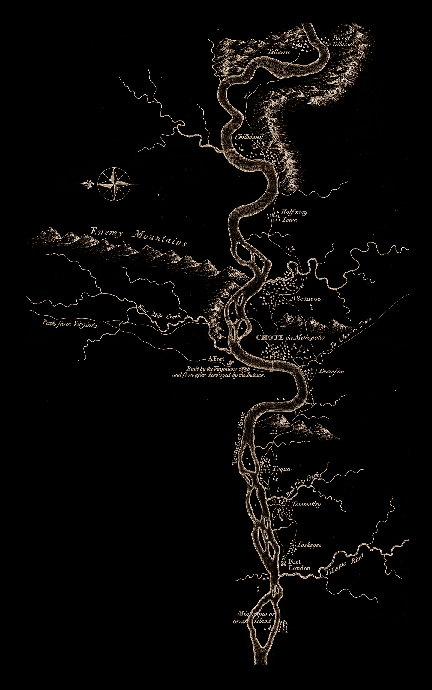
He was not a neutral observer. He was a British officer moving through a landscape that his government had spent thirty years trying to claim, simplify, and control. But he drew carefully. The river bends are accurate. The town locations hold. The mountains he labeled Enemy Mountains still stand.
He recorded what he saw without fully understanding what he was looking at. The note beside Fort Loudon reads: Built by the Virginians 1756 and soon after destroyed by the Indians. He wrote “destroyed by the Indians” as if it were an act of irrational violence. It was the Cherokee reclaiming their river.
He drew the world as it was. He did not know he was drawing what would be lost.
What the map shows
The river running top to bottom is the Little Tennessee. The towns clustered along its banks are the Overhill settlements — the heart of the Cherokee world that Moytoy of Tellico governed, that Attakullakulla spent his life trying to protect through diplomacy.
Timberlake drew this map thirty-two years after the coronation at Noquisi. The towns were still above water. The sacred fire at Chota was still burning. Nanye’hi had already become Ghigau — she held the title for twenty years by the time this map was made.
- Chote the MetropolisItsa’sa. Peace town. Mother Town. Sacred fire. Inundated 1979.
- TennefreeTanasi. The origin of the name Tennessee. Inundated 1979. The state kept the name.
- ToquaOverhill town on the south bend of the river. Inundated 1979.
- TommotleyOverhill town. Site of significant archaeological record. Inundated 1979.
- ToskegeeOverhill town near Fort Loudon. Inundated 1979.
- ChilhoweyOverhill town on the upper river. Inundated 1979.
- SettacooOverhill town near Chota. Inundated 1979.
- Fort LoudonBritish fort, 1756. Destroyed by the Cherokee, 1760. Site inundated 1979. Partially reconstructed on higher ground.
Tellico — Talikwa, the war town where Moytoy governed — does not appear on this map by that name. It sat further up the Telliquo River, marked at the map’s eastern edge. It too went under in 1979.
Of all the Overhill towns and sites, only the Noquisiyi mound in Franklin, North Carolina survived the flood. In February 2026, its deed was transferred to the Eastern Band of Cherokee Indians. The mound that witnessed the coronation in 1730 has come home.
Timberlake mapped a living world.
The TVA archived it underwater.
The novel begins where this map ends, thirty years earlier, when the towns were new and the river ran free.
Emperor of the Cherokee
A novel by Stephen E. Dinehart IV · April 3, 2026
The story of the people who lived in these towns, on this river, before the water. Written by a documented descendant of Moytoy of Tellico.
Get the book on Amazon Return to the full story